July 25, 2013: Old Eastern Marsh Trail / Clipper City Rail Trail
I decided to combine these two rail trails into one review since they were made from the same railbed and as of May 17, now join through the Gillis Rail Trail Connector with minimal use of the road. I think it made sense to do the review this way.
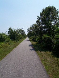
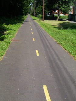
After doing my tour of the Salisbury Point Ghost Trail, I took a half mile ride over to Mudnock Road where the northern end of the Old Eastern Marsh Trail is. Like Salisbury's other rail trail, it is well marked with great signage and mileposts every tenth of a mile. Unlike Salisbury Point however, this trail is paved. It runs 1.35 miles from Mudnock Road all the way to the former railroad bridge at the Merrimack River.
Since much of the trail goes through a marsh, there isn't too much shading for the northern half of the trail. However, there are several opportunities to look out at the scenery with informative signs and benches in place. After the marsh, it becomes more wooded. There is one road crossing six tenths of a mile from the Merrimack to watch out for, but other than that, it is a clear shot on a very flat terrain. The trail is also in great (continue reading...)
July 24, 2013: Salisbury Point Ghost Trail
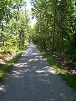
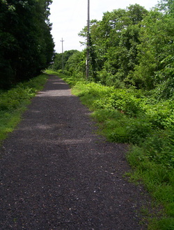
About a mile from the southern terminus of Amesbury's Riverwalk is the continuation of the same railbed. The Salisbury Point Ghost Trail runs east from Rabbit Road to Lions Park, near the town center of Salisbury. It is packed gravel and is 1.75 miles in length on a surface that is essentially "pancake flat".
I rode my bike from Amesbury, taking Elm Street over to Route 110 where I took a left. After passing underneath I-95, I took a left onto Rabbit Road. The trailhead is less than a quarter mile from Route 110 with parking available for a few cars. The most prominent landmark by the trailhead is the solar farm, which apparently is the largest in New England. It took about a half mile of cycling on the trail until I finally passed it.
With exception to about two tenths of a mile on the western end, the trail is in the shade with plenty of tree cover. This was especially pleasant on a hot day. I found that the surface was consistent throughout and about as smooth as you could hope for on an unpaved rail trail. There are two crossings to watch out for, one at Bartlett Street and (continue reading...)
July 21, 2013: Amesbury's Riverwalk
After finishing my work at the Jay McLaren Memorial Trail in Merrimac, I drove a few miles over to Amesbury to start a tour of four separate rail trails that provide a route from downtown Amesbury to the MBTA station in Newburyport. The network is approximately 75% off-road.
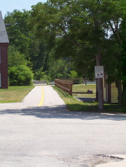
Amesbury's Riverwalk is relatively short (1.35 miles) in it's current format, but provides an excellent link from downtown to Carriage Town Marketplace. The strengths of the trail are its focus on the Powow River, the high quality of the paved surface, and the incorporation of historical enhancements along the way.
I parked in the municipal parking lot next to the Barn on Water Street and rode a very short distance to the start of the trail next to the DPW garage. The first part of the trail wraps along the river in an indirect fashion. However, what this area lacks in directness, it gains in scenery. Soon however, I was on the part of the trail that actually uses the former railbed here. Much of the trail runs along residential areas including a condominium complex that has its own access to the trail. (continue reading...)
July 17, 2013: Jay McLaren Memorial Trail
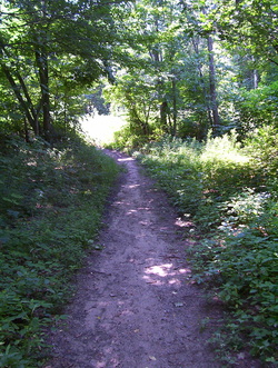
Despite the heat, I decided to check out five separate rail trails today. I started off in Merrimac to revisit a trail that I hadn't been to in a few years, the two mile Jay McLaren Memorial Trail. This railbed was originally a spur to Merrimac from Newton Junction in Newton, NH. The trail is definitely a no-frills pathway. Washout and sandy spots exist throughout with several bumps on the trail due to ATV use.
It is worth mentioning that there is very little information online about this trail. It seems like a lot of pride once went into it. Now, there are no signs that inform the trail user of where they are. The parking area and trail access was once signed, but now I'm not even sure if it's legal to access the trail there.
I will say, however, there are many nice aspects to this trail. Depending on the season, it is imperative to bring bug repellent. I was glad to have done so, because although I was not getting bitten, the bugs were all around my bike helmet. I started unsure of myself because that parking sign was not where I remembered it. Having no idea it (continue reading...)
July 14, 2013: Independence Greenway
After coming out of the Kristen Crowley Trail onto Lowell Street, I realized that I was on the on-site road connection of the Independence Greenway. The trail is split into two sections, most likely because of the issues of getting by I-95 and Route 1. Since I didn't study the map very carefully, I wasn't entirely certain how to make the connection, but and East Coast Greenway sign helped me out, at least somewhat.
The arrow pointed to the right just after the entrance to Beth El Cemetery. I interpreted the connection as taking a right there, since the next available right off of Lowell Street was a good quarter mile away. You can still get there through the cemetery as I found out, but the official (and more respectful) way of connecting is to take a right on Peabody Street. The trailhead is on the left.
I made my way to the western terminus of the trail at the Lahey Clinic next door to the North Shore Mall. From there my journey began on a westerly (Continue Reading...)
July 13, 2013: Bradford Rail Trail
I had the pooch with me for this one. He isn't able to go extended distances, but for a rail trail that is only about a half mile in length, the one mile round trip was perfect for him. This one isn't much if you are looking for a long hike, but it's a start for a city like Haverhill with so many fiscal challenges. Mayor James Fiorentini and the Friends of the Bradford Rail Trail are on board for an extension with the hope of eventually reaching the Groveland border. This would require approximately 2.25 additional miles of trail converted from the old Georgetown spur of the Boston & Maine Railroad.
I started off by parking in the Roma Restaurant parking lot off of Middlesex near the Basiliere Bridge. It's not exactly clear where the eastern terminus of the trail is as it begins to enter a work zone. A sign exists informing users of the work zone and not to enter. Because it was a weekend, I ventured over to the bridge and noticed a former party scene underneath with graffiti all over the structure. On the (continue reading...)
I started off by parking in the Roma Restaurant parking lot off of Middlesex near the Basiliere Bridge. It's not exactly clear where the eastern terminus of the trail is as it begins to enter a work zone. A sign exists informing users of the work zone and not to enter. Because it was a weekend, I ventured over to the bridge and noticed a former party scene underneath with graffiti all over the structure. On the (continue reading...)
July 12, 2013: Topsfield Linear Common / Wenham Rail Trail / Danvers Rail Trail / Kristen Crowley Trail
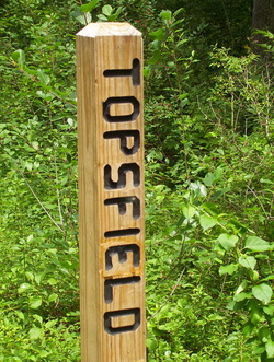
The weather was nice with a cooling breeze, so I decided to start my rail trail project by heading over to Topsfield to check out their Linear Common. It's an interesting title that sounds a bit more intriguing than the everyday "rail trail" sound.
The Topsfield Linear Common (2.25 miles) connects to a larger 8.55 mile completed segment of the East Coast Greenway, which includes the Wenham Rail Trail (1.3 miles), the Danvers Rail Trail (4.35 miles), and the Kristen Crowley Trail (0.75 miles) in Peabody.
I wasn't quite sure where to park, but I ended up finding a few parking spots adjacent to the Route 1 trailhead. I noticed about seven or eight people using the trail right off the bat. Heading north, homes lined the western side of the trail as I made my way toward Topsfield Center. After three tenths of a mile, I crossed Summer Street and discovered the main parking area across from the St. Rose of Lima Church on (continue reading...)
